Like North American Wildlife & Habitat on Facebook
Order the book on Amazon - http://a.co/hu15aBd
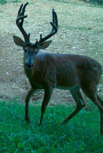
QUALITY DEER MANAGEMENT WORKS ON SMALL PROPERTY
SEE THE RESULTS
Wildlife Management & Wildlife Management Plan
This section is dedicated to the needs of landowners.
I am here to help landowners get started with improving wildlife habitat on their land in my area of Southern Missouri and a few neighboring states.
This creating a Wildlife Management Pland is exciting first step in and will make a big impact for wildlife on private lands throughout the country.
I am here to help landowners get started with improving wildlife habitat on their land in my area of Southern Missouri and a few neighboring states.
This creating a Wildlife Management Pland is exciting first step in and will make a big impact for wildlife on private lands throughout the country.
DEVELOPING A WILDLIFE MANAGEMENT PLAN
This is just one section of a class that I took in 2003. But, one of the most important parts in making and accomplishing goals, when managing land for wildlife.
I have always said when managing your land for wildlife, the question you need to constantly ask yourself and then answer time and time again until the answer changes from the land to the animals you are trying to manage. WHY DOES THE DEER, TURKEY OR ANIMAL WANT TO BE HERE?
That question is the simple way to look at what is below. But I hope it will help you understand the information below in developing a wildlife management plan.
MASTER WILDLIFER
Managing Wildlife on Private Lands in the South
Southern Region Satellite Course
February – March 2003
Developing a Wildlife Management Plan
Land managers and landowners who are successful at managing wildlife carefully plan and target management activities to accomplish their objectives, minimize expenses, and ensure the long term productivity of their property for wildlife other resources. Wildlife management plans are simply a written guide for how, when, and where to implement habitat improvement practices.
Developing a management plan yourself or contracting a natural resource professional to develop a plan for forest or farm land is a wise investment of time and money.
Components of an effective wildlife management plan include:
Land management goals and objectives (by priority),
A resource inventory,
Site specific habitat improvement recommendations,
A schedule for conducting management practices,
Record keeping and evaluation of management efforts and their impacts on wildlife habitat.
A carefully developed plan provides a logical approach for using an assortment of habitat improvement practices. Some government cost-sharing programs also require that a management plan be written before cost-sharing funds are provided to landowners.
Steps in Writing a Plan
No two wildlife management plans are exactly the same. Plans vary depending on management objectives, habitat and site characteristics, financial resources, existing land uses (such as forestry or farming), and the individual(s) writing the plan. Assistance for developing and writing plans in available from a variety of sources such as private consulting firms, state Department of Natural Resources (DNR), state Forestry Commissions (FC), and the USDA Natural Resources Conservation Service (NRCS). Natural resources professionals from government agencies can provide advice and guidance in developing wildlife habitat management plans at no cost to the landowner.
A multi-agency effort, called the Forest Stewardship Program, can also provide management plan assistance for forest and farm owners interested in managing their lands for a diversity of natural resources. Some forest industry landowner assistance programs also provide guidance in developing management plans. In addition to agency and forest industry assistance programs, natural resource consultants also provide management plan expertise and service for a fee. Consultants should be professionally trained and designated as registered forester and/or certified wildlife biologists.
Wildlife habitat management plans can be prepared in a variety of ways depending on available resources. Large timber companies often have sophisticated computer programs for recording, analyzing and displaying land use/management information.
The advantage of using a computer-based recording and reporting system is that a large amount of diverse information can be quickly updated and easily accessed in a variety of formats (maps, charts, text) for making management decisions. The disadvantage is that these systems are usually cost-prohibitive for he average landowner, although some private consulting firms offer these services. More typically, management plans include a written and visual description (sketch) of the land and other resources with recommendations for habitat improvements.
Whatever the approach, it is important that management plans be usable and flexible.
A property inventory is a two-step process that includes:
Identifying physical features (such as land use and vegetative types, water sources, terrain, soils, ad other natural and man made features) from various maps and aerial photographs; and
A more detailed in-the-field survey of land features that are not easily identified from maps or aerial photographs, and field observations should be included as a sketch or computer generated base map and as a written description in the management plan.
Most land features can be identified using topographical quadrangle maps from the U.S. Geological Surveys, recent aerial photographs from the county USDA Farm Services Agency office, soil surveys and soil maps from the county USDA Natural Resource Conservation Service office, and property blueprints (plats) from the county tax assessor’s office. These items are invaluable tools for developing a wildlife habitat management plan. The sketch map and written description should include information from maps, surveys, and aerial photographs such as property location, soil types and capabilities, topography, current land-use, vegetative cover types, streams and other water sources, boundary lines, rights-of-ways, road systems, and other important features. If there is too much information to include on one sketch map separate maps should be drawn. One map could include major features such as soil and vegetation cover types, while a second map could include other pertinent information. Transparent acetate sheets can also be used as overlays on sketch maps to provide additional information on sketches.
The next step is to add additional information to the sketch and written description that could not be identified from resource maps or aerial photographs. This is accomplished by walking over the property with the sketch map and noting unique features that might enhance or restrict wildlife habitat management efforts. Special attention should be given to the presence, arrangement and condition of natural vegetation that provides food and cover for wildlife of interest. Landowners and managers should also note existing timber and mast-producing trees and other vegetation on the property, as well as other areas that could support additional trees, shrubs, grasses, and legumes that benefit wildlife.
On-the-ground inventories should be made at least twice, at dawn and dusk, because these are peak activity periods for many species of wildlife. Walking over the property during these times helps determine what wildlife species are present on the land. Other signs of wildlife, such as scat or droppings, tracks and travel lanes, feeding area, beds, nests, dens, burrows, and sounds can also help identify wildlife species that use your land. Special attention should be devoted to determining if threatened or endangered species are present on the property. Sites that support threatened or endangered species should be noted on the sketch map. These areas will require special attention and specific management considerations.
What Equipment and Facilities Do You Have?
Most farm and forest and owners have some equipment and facilities that can be used for wildlife habitat improvement practices. A farm tractor can be used for establishing food plots, creating and maintaining fire lanes, and disking natural openings. If no equipment is available, some habitat improvement practices can be contracted out to local farmers and others who own tractors, disks, and planting equipment. Consultants usually have a list of vendors that own management equipment and provide habitat improvement practices.
Every effort should also be made to integrate wildlife habitat improvement practices with existing farm and forestry operations to lower costs. The key is advanced planning and coordination with other land management activities.
Information to Include in a Written Inventory of Compartments (Description of features identified on the sketch)
Compartment Number (identifies compartment on land tract)
Management Objectives (wildlife, timber, and other land uses)
Location of Compartment
Description of Compartment:
Size of Compartment (number of acres)
Soil type(s) and Capabilities
Site Index
Drainage
Aspect
Dominant Vegetation
Timber Inventory:
Timber Species Distribution
Age Classes
Stand Density (number of trees per acre or basal area
Average Sizes
Timber Volume/Basal Area
Timber Management History
Special Trees (number of mast-producing trees, den trees, snags)
Game and Nongame Habitats:
Wildlife Feeding Areas and Plant
Brush Piles and Windows
Nesting Sites and Water
Unique Areas:
Special Places and Historical Sites
Threatened and Endangered Species Habitat
Areas Presenting Special Problems and Opportunities:
Stream Banks
Stream Management Zones (SMZ’s)
Steep Slopes
Glades
Coves
Wetlands
Existing facilities, such as an old house or barn, are useful for housing management personnel and storing equipment. Labor personnel can stay on the property, while management activities are being conducted, for extended periods to reduce travel and expenses. Old barns and sheds can also be used to store seeds, fertilizers, lime equipment and other management tools and materials. Barns and old houses can also be refurbished and used as lodging for hunters or other guests.
Financial Considerations
Management expenses depend on objectives, availability of labor and equipment, current land conditions, and whether or not wildlife habitat enhancement practices can be integrated with other land management operations such as forestry or farming. Where possible, wildlife habitat improvement practices to reduce costs and disturbance to wildlife.
Management practice costs should be criteria for selecting the level and intensity of wildlife habitat improvement practices are more costly. Management cost for some species of wildlife, like bobwhite quail, that require early successional stage habitat (grasses and forbs), is quite high because of the intensity and frequency of management efforts to maintain habitat at preferred stages. Management practices like prescribed burning and disking may similar effects on enhancing vegetative growth, but in general, an area can be burned at a lower cost than it can be disked. Management costs per acre are lowered as they are applied over a larger area. In other words, management costs per acre are lower on large land tracts than on small tracts of land. Management costs can also be reduced if they qualify for cost-sharing assistance. For more information on cost-sharing assistance programs contact your local NRCS or Farm Services Agency office.
Step 3 Designating Management Compartments
Farms and woodlands are seldom uniform in the distribution of plant species, soils, productivity, and management potential. Because of these differences, a variety of management strategies are necessary for enhancing wildlife habitats across an individual farm or forest. Land tracts should be divided up into management units called “compartments” to make the process of recommending and conducting habitat recommending and conducting habitat improvement practices over a large and diverse area easier and more efficient. Compartments are areas that have similar characteristics such as vegetation, soils, topography, productivity, or other features. Compartments may be a pine plantation, hardwood stand, swamp, riparian forest, old homesite, or any particular field or field system. Because of their uniqueness, compartments can usually be identified from aerial photographs and maps.
After dividing a land tract into compartments, each compartment’s potential for producing quality wildlife habitat should be evaluated using information from the resource inventory. This information should be used to develop site specific management objectives and recommendations for each compartment. Wildlife habitat improvements should focus first on compartments that have the greatest potential (productivity) for providing wildlife habitat.
Step 4 Selecting Habitat Improvement Practices
After the current conditions and management potential of each compartment are determined, habitat improvement practices for wildlife should be reviewed and selected for each compartment.
Write down practices that would be most appropriate for your land, and then discuss them with a natural resource professional (a certified wildlife biologist or registered forester). When considering management alternatives, be sure to consider the impacts of each practice, timing, cost, and the potential for each practice to complement or conflict with on-going land management operations on your tract and adjacent tracts managed by others.
Compartment Record Sheets
Compartment record sheets, (see next page Figure 2) are vital components of a wildlife management plan. They are standardized information forms (8 ½” x 11”)
That record compartment management objectives, compartment descriptions, management recommendations, schedules of management activities, and records of management activities, and records of management activities and impacts. Below is an example compartment record sheet that can be modified to meet landowner needs.
Figure 2. An example format of compartment record sheets for management plans.
Compartment No. _______________________
Management Objectives (includes priorities for wildlife, timber and other land uses)
Wildlife _______________________________________________
Timber _______________________________________________
Other _______________________________________________
Location of Compartment ____________________________________
Description of Compartment
(Narrative description of compartment)
Size of Compartment ______________ acres
Compartment Characteristics:
Soil type and capabilities ___________________________
Site index ____________________________
Drainage ______________________________
Aspect _______________________________
Trees species composition _______________
Volume/basal area of timber ______________________
Trees per acre ______________________ Mean DBH ___________________
(Diameter of tree at breast height)
Mast-Producing Trees ___________________________
Fruit-bearing shrubs and herbaceous plants _________________________
Den Trees and Snags ___________________________
Specific wildlife habitat information _________________________
Activities to be conducted (in a calendar year from start to finish)
1.
2.
3.
4.
5.
6.
7.
8.
9.
10.
Record of wildlife, timber and other management activities:
Activity Year
Impact of Management Activities ______________________________
Important Tools for Developing a Wildlife Habitat Management Plan
Aerial Photographs are used to locate and identify natural and man-made features such as vegetation and forest types, land use, water sources, roads, rights-of-ways, buildings, and other features. They are also useful in delineating management compartments. Aerial photographs are available in black and white, color or color infrared and in various scales. An ideal Aerial photographs can be obtained from the county USDA Farm Services Agency, county USDA. Natural Resource Conservation Service office or can be contracted to be taken by private natural resource firms.
Topographical Maps helps to locate property in relation to physical features wuch as elevation, roads, water sources, and other land characteristics. Topographic maps can be obtained from the U.S. Geological Survey or local map vendors.
County Soil Surveys provide a description and map of soil types in a county. Soil surveys also provide soil suitability and productivity ratings for growing timber, producing wildlife habitat, and other land uses. They often include a description of the vegetation on various soil county USDA Natural Resource Conservation Service office.
A Field Notebook and Tape Recorder are useful for recording observation during the field inventory. Information recorded in the field can be transferred later from field notes and a tap recorder to the management plan.
Field Guides are useful for identifying wildlife, trees, shrubs, vines and herbaceous vegetation during the field inventory. Guides with detailed descriptions and color photographs are ideal.
Landscape Architecture Templates are useful for drawing trees, shrubs, and other natural and man-made features on sketch maps. Templates can be found at most draftsman supply stores.
A Camera can be used to document wildlife habitat conditions before and after management practices.
Information from Earlier Land Management Plans is invaluable in describing, recommending, and scheduling wildlife habitat improvement practices.
Record Keeping and Evaluation Management plans are dynamic documents that should be evaluated and updated periodically. Evaluations should be made annually for each compartment so that effective practices can continue to be implemented, while those that produce few or no results can be modified or discarded. Recording impacts of management efforts on compartment sheets is important in helping to evaluate the effectiveness of certain management practices. Keeping a log book of observations and changes that valuable information for evaluating management efforts. Recorded observations should include estimates of vegetative responses to management practices as well as wildlife responses, such as deer and turkey use of food plots. Food plots that are not heavily utilized by and moved to more suitable sites after an appropriate amount of time to allow wildlife to accept them. There is no substitute for good record keeping as a basis for evaluating the effectiveness of wildlife management practices.